Frigid Nashville: Sub-Zero Chills and Freezing Fog Follow Historic Ice Storm
A City in the Grip of Winter
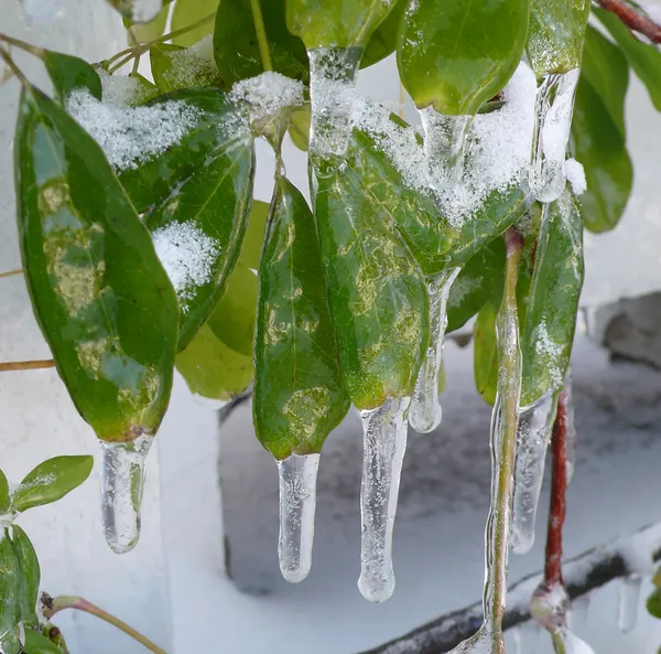
Nashville residents are waking up to a brutal morning as the city continues to grapple with the aftermath of what Mayor Freddie O’Connell has described as a historic ice storm. While the sun is expected to make an appearance later today, Wednesday, January 28, 2026, marks one of the most dangerously cold stretches in recent memory for Middle Tennessee. The city remains in a state of high alert as recovery efforts for power and infrastructure continue under extreme conditions.
Morning: Dangerously Cold with Freezing Fog
The day begins with a sharp sting, as temperatures in Nashville plummeted to a morning low of 6°F. When factoring in the wind, residents are experiencing sub-zero wind chills that make any outdoor exposure hazardous. Adding to the morning difficulty is a Freezing Fog Advisory issued by the National Weather Service. This phenomenon, combined with the significant ice and snow already on the ground from the weekend’s storm, has created a thin, invisible layer of ice on many surfaces. Travel is highly discouraged this morning, as bridges and overpasses are particularly treacherous for the AM commute.
Afternoon: A Brief Thaw and Transitioning Skies
As we move into the afternoon hours, there is a glimmer of relief from the overcast start. The sky is expected to transition to clearer conditions, with the high temperature forecasted to hover right at the freezing mark, reaching approximately 32°F to 34°F. While this will not be enough for a total melt of the heavy ice accumulation, the expected sunshine should help soften some of the ice on main thoroughfares. Winds throughout the day will remain relatively light, peaking between 6 and 8 mph, which will provide a small window for crews to continue clearing debris.
Evening: The Great Refreeze
Once the sun sets, the region will experience a rapid refreeze. Clearer skies will allow heat to escape quickly, and temperatures are predicted to drop back into the mid-teens, hitting a low of approximately 16°F. Any slush or standing water that formed during the afternoon’s minor thaw will turn back into solid ice, making evening travel just as dangerous as the morning hours. Residents are urged to remain off the roads if possible as black ice becomes a major concern.
City-Wide Impacts and Alerts
- School Closures: Metro Nashville Public Schools (MNPS) will remain closed today and Thursday due to the hazardous road conditions.
- Utility Recovery: NES teams are working around the clock to restore power to the more than 135,000 homes and businesses that were left in the dark following the ice storm.
- Service Suspensions: The Nashville Department of Waste Services has suspended residential curbside collection for Wednesday, as many neighborhood routes remain obstructed by fallen trees and ice.
- Safety Resources: Warming centers remain open 24/7 across the city, including the Nashville Fairgrounds and several Metro Police precincts, to assist those without power or adequate heating.